I mentioned Professor Emeritus Yi-Fu Tuan in an earlier post, his importance as a humanist geographer and teacher. Recently a group of former students and librarians from the University of Wisconsin-Madison Geography Department began to make his "Dear Colleague" (1985-2008) letters available to the public via the portal here. See, for example a letter inspired by a lunch with noted cartography historian David Woodward (15 December 1985):
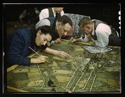
"A map is a two-dimensional model of reality. Or, as David puts it, a model is a three-dimensional map. Maps and models are both artifacts, but a model can be a feature in the landscape -- indeed, a monumental feature. In traditional societies, the house can often be interpreted as a model of the cosmos. The floor plan of the house, with its partitions and directional points, are a two-dimensional map of the cosmos. The three-dimensional house is a model -- a three-dimensional map -- of the larger reality of the heavens and the earth."
Photograph above: Marjory Collins, Camouflage class in New York University, where men and women are preparing for jobs in the Army or in industry, New York, N.Y. They make models from aerial photographs, re-photograph them, then work out a camouflage scheme and make a final photograph, March 1943. Library of Congress, Prints and Photographs Division, Washington, D.C. on flickr.
No comments:
Post a Comment