During the 1880s and early 1890s big real estate development "syndicates" proliferated. Platting activities simultaneously peaked in such cities as Cleveland, Chicago, Detroit, Milwaukee and San Francisco.(1)
The previous post introduced one such enterprise in San Antonio, Texas. In New York, Maximilian Morgenthau's syndicate was especially powerful, known for its lucrative ventures on Amsterdam Avenue, 179th, 180th and 182nd Streets.
In Kansas, the so-called "Big Syndicate" formed in the spring of 1887. Organized as the Atchison Land, Improvement & Investment Company, its investors planned to develop a street railway and dummy line. Missouri architect Max J. Scholer surveyed the proposed transportation corridor and also designed the syndicate's two-story Commercial Street property. He independently acquired properties along the proposed dummy line in the city's Highland Park subdivision.(2)
Later that year, the General Synod of the Evangelical Lutheran Church responded to the boom by establishing Midland College in the Big Syndicate's subdivision. Other municipalities that had vied for the foundation included Beloit, Minneapolis and Topeka, Kansas and Beatrice, Grand Island and Lincoln, Nebraska. But Atchison and its syndicates offered the Synod $50,000 for buildings, 25 acres of land, and net profits from land sales. By January 1889 the college had completed an ambitious new brick and grey stone building.
The 1887 Kansas Boom was short-lived & Highland Park sales were especially lackluster. Within its first two years, Midland College enrollments dwindled by over 25%.
(1) Fisher, Ernest M. "Session of Real Estate Speculation: Speculation in Suburban Lands." American Economic Review 23:1, Supplement, Papers and Proceedings of the Forty-fifth Annual Meeting of the American Economic Association (March 1933), p. 153.
(2) The Atchison Globe (2 June 1887).
Showing posts with label railroads. Show all posts
Showing posts with label railroads. Show all posts
Tuesday, April 5, 2016

Tuesday, December 22, 2015
Merry Travels/Holidays!

May your travels and festivities this season be equally remarkable!


Tuesday, July 21, 2015
1925 Shreveport Fire

Strong winds carried the fire northeast, bounded by the Texas & Pacific Railroad. Firemen responding to the alarm -- from the engine house across the street -- arrived only to discover they had no access to water. In the map detail below, the fire station is marked in red, O'Brien's property is marked in white.

When the fire was contained at the T & P's main line, there had been at least two fatalities, nearly 200 homes were destroyed, and some 1200 residents displaced. African-Americans and recent immigrants comprised the majority of the victims. Insurance adjusters reported that only 60% of the losses were covered by policies.(2)
The Southeastern Architectural Archive's Map of the Area Involved in Conflagration at Shreveport, LA (shown above) was issued by the Louisiana Fire Prevention Bureau in New Orleans. We recently discovered it accordion-folded and hidden away inside the binding of a Sanborn Fire Insurance Atlas. The cartographer mapped out the fire's source, the wind direction and all of the "risks" (i.e. structures) that were destroyed.
A recent Washington Post blog addressing racial divides across American cities highlighted Shreveport and it reminded us of our "Conflagration" discovery.
Utilizing Dustin Cable's Racial Dot Map, WP blog authors Emily Badger and Darla Cameron discussed historic transportation arteries in the context of racial segregation.

From Cable's map, we cropped the Allendale fire and surrounding neighborhood in the detail above. Note that Texas Avenue largely follows the perimeter of the old T & P line.
(1)"Negro Apes Nero, Playing Piano as Shreveport Burns." The Times-Picayune 7 September 1925.
(2)"Losers in $700,000 Fire Paid $358,885." The Times-Picayune 7 October 1925.
Images above: Two Details, Louisiana Fire Prevention Bureau. Map of the Area Involved in Conflagration at Shreveport, LA. New Orleans, LA: 1925. Fire Insurance Atlases, Southeastern Architectural Archive, Special Collections Division, Tulane University Libraries.
Detail. Dustin Cable. Racial Dot Map. Demographics Research Group, the Weldon Cooper Center for Public Service, University of Virginia, 2013.
Wednesday, May 6, 2015
Terra Cotta


In the early twentieth century, terracotta designs by architects proliferated in the pages of The Brickbuilder, a trade journal founded in Boston.
Notable published designs by New Orleans architects are included below. See if you can find them on buildings in the Crescent City and Opelousas.


Records of the Northwestern Terra Cotta Company are located at the National Building Museum in Washington, D.C.
In 1906, the Ludowici Roofing Tile Company (also based in Chicago) established an office and warehouse in New Orleans due to the large amount of material that it was shipping to Panama. Ludowici's traveling sales representative J.D. Duffy was reassigned to the permanent position.(1) The bunglow community at Derby Place (Third Municipal District) utilized the company's tiles. Architect-clients included Walter Cook Keenan (1881-1970), who specified the tiles for the Jones Residence at 20 Neron Place (1923) and his apartment building at Carrollton Avenue and Green Street. Ludowici roofing was adopted for the Hugh L. White residence in Columbia, Mississippi and the Charles Ledet residence in Houma, Louisiana.(2)
The Southeastern Architectural Archive maintains a number of Ludowici catalogs, now digitized via the Internet Archive's Building Technology Heritage Library.
Other architectural terracotta suppliers who maintained a New Orleans presence include the following:
St. Louis Terra Cotta Co. (St. Louis), Frank Bethune, agent. 808 Perdido Street (1919).
Federal Terra Cotta Co. (New York), J.T. Mann & Company, agents. 909 Union Street (1919).
Atlantic Terra Cotta Co. (New York), Ole K. Olsen, agent. 822 Perdido Street (1920).
[See Building Review (1913-1922) for listings of local agents for various architectural trade concerns].
New Orleans structures with notable terracotta include:
Pere Marquette (817 Common Street) -- American Terra Cotta & Ceramic Company
Maison Blanche (901 Canal Street) -- Atlantic Terra Cotta Company
American Bank & Trust Company (200 Carondelet Street) -- Federal Terra Cotta Company
Louisiana Supreme Court building (400 Royal Street) -- Atlantic Terra Cotta Company
Lyons building (224 Camp Street) -- Northwestern Terra Cotta Company
Morris building (600 Canal Street) -- Northwestern Terra Cotta Company
Tulane building (211 Camp Street) -- Northwestern Terra Cotta Company
Grunewald Caterers (926-28 Canal Street) -- Northwestern Terra Cotta Company
(1)"Another Northern Firm Establishing Offices." The Times-Picayune 1 January 1906.
(2)"New Orleans Greatest Tile Center: Roofs May Rival Old World Cities." The Times-Picayune 23 May 1926.
Images above:
Top four: Advertisements, The Daily Picayune. 23 July 1872; 30 March 1887; 19 September 1888; The Times-Picayune 1 September 1903.
Bottom seven: All from The Brickbuilder (1901-1910). Architects, from top to bottom: Andry & Bendernagel; Diboll, Owen & Goldstein; Favrot & Livaudais; Favrot & Livaudais; Toledano & Wogan; Toledano & Wogan; Toledano & Wogan.
Tuesday, December 23, 2014
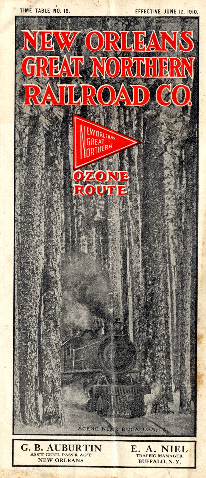
Harvey Murdock in Bogalusa

Murdock (†1922), a builder and developer most known for Brooklyn and Manhattan row houses, was given the task of designing the section houses at intervals every seven miles along the system. Section houses consisted of foremen's residences and laborers' houses. He also drafted plans for general office buildings and shops in Bogalusa.

As we reported in an earlier post, New Orleans architect Rathbone DeBuys worked on designs for Bogalusa during the second decade of the twentieth century.
For more information, see: "Great Northern Begins Work on Line to Jackson." The Daily Picayune 25 December 1906.
Images above: New Orleans Great Northern Railroad Co. Route Map & "Scene Near Bogalusa, LA" Cover. Time Table No. 16, Effective 12 June 1910. Martin Shepard Office Records, Southeastern Architectural Archive, Special Collections Division, Tulane University Libraries.
Monday, December 15, 2014
NEW! L&N RR Finding Aid

For researchers interested in the history of postbellum southern passenger and freight trains --especially accommodations for employees and travelers -- this collection may prove significant. It includes plans for rural and urban stations, some with segregated waiting rooms and some consisting of nothing more than shed roofs or outhouses. For those researching the transport of cotton, Georgia marble or Appalachian coal through southern markets, the collection may also provide beneficial information.
To see a complete inventory of the drawings, click here.
Image above: Louisville & Nashville RR Chief Engineer’s Office. Mississippi City Passenger Station. Elevation on Track. Mississippi City, MS. February 1899. Louisville & Nashville RR Engineer's Office Records, Southeastern Architectural Archive, Special Collections Division, Tulane University Libraries.
Thursday, September 19, 2013
The Fatal Switch


C. Milo Williams later photographed safety improvements along the same I.C.R.R. track (lower image). He indexed his series of images "Bofinger switches" in reference to New Orleans businessman-inventor William H. Bofinger. Just a few days before the Sauvé collision, Bofinger had received a patent for a new switch that allowed an engineer on a moving train to "throw the point of the switch against the main track without leaving his engine."(2) A few months after the accident, Bofinger filed a second railroad patent, his so-called "switch-stand'" -- essentially a cage-enclosed switch that prohibited tampering. It is the latter that Williams documented in Jefferson Parish.
Among Bofinger's less safety-conscious inventions, one must mention his 1894-95 Rocking Chair Fan Attachment.
(1)"The Crash of the Cannon Ball." The Daily Picayune (21 June 1891): p. 4.
(2)No. 453,690. Patented June 9,1891.
Images above: C. Milo Williams, photographer. Williams Family Records, Southeastern Architectural Archive, Special Collections Division, Tulane University Libraries.
Tuesday, April 9, 2013
Louisville & Nashville Railroad 1916

Image above: L & N R.R. Local Time Tables and Commuter Rates to Gulf Coast Points. Issued June 1916. Martin Shepard Office Records, Special Collections Division, Tulane University Libraries.
Subscribe to:
Posts (Atom)